Property Record
4320 Keith Bridge Rd, Cumming, GA 30041


NEARBY LISTINGS FOR SALE OR LEASE
-
-
View all Cumming listings for lease on LoopNet.com
Property Detail
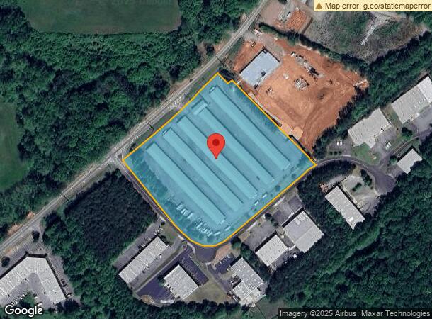
4320 Keith Bridge Rd
Atlanta-Sandy Springs-Roswell, GA
North
254-035
14-1 574 LAND & LT5-7 NORTH 306 IND PK
Industrialgeneral
Forsyth
X
Georgia
13117C0070G
5-7
2023
8.47 AC
2024
N Fulton/Forsyth County
130102
Atlanta
3,060 SF
DEMOGRAPHICS near 4320 Keith Bridge Rd
1 Mile
3 Mile
5 Mile
2024 Total Population
1,162
19,394
55,141
2029 Population
1,357
22,502
64,665
Pop Growth 2024-2029
+ 16.78%
+ 16.03%
+ 17.27%
Average Age
39
39
40
2024 Total Households
378
6,557
19,271
HH Growth 2024-2029
+ 16.67%
+ 16.10%
+ 17.39%
Median Household Inc
$81,034
$100,256
$101,345
Avg Household Size
3.10
2.90
2.80
2024 Avg HH Vehicles
2.00
2.00
2.00
Median Home Value
$517,482
$374,775
$389,953
Median Year Built
2001
2003
2001
Nearby Places
- Restaurants
- Banks
- Shops
- Fitness
- Groceries
SALE & LEASE HISTORY
LISTING DATE
SALE/LEASE

Nov 26, 2018
For Lease
Nearby Properties
Address
Land Use
TOTAL SIZE
Lot Size
Zoning
Address
Land Use
TOTAL SIZE
Lot Size
Zoning
57,180 SF
61.71 AC
RES6
Address
Land Use
TOTAL SIZE
Lot Size
Zoning
34.02 AC
MP
Address
Land Use
TOTAL SIZE
Lot Size
Zoning
19.21 AC
M1
Address
Land Use
TOTAL SIZE
Lot Size
Zoning
152,668 SF
41.92 AC
CBD
Address
Land Use
TOTAL SIZE
Lot Size
Zoning
50,875 SF
420.29 AC
A1
Address
Land Use
TOTAL SIZE
Lot Size
Zoning
98,743 SF
12.61 AC
CBD
Address
Land Use
TOTAL SIZE
Lot Size
Zoning
74,796 SF
9.92 AC
CBD
Address
Land Use
TOTAL SIZE
Lot Size
Zoning
192,550 SF
21.11 AC
CBD
Address
Land Use
TOTAL SIZE
Lot Size
Zoning
59,534 SF
16.93 AC
CBD
Address
Land Use
TOTAL SIZE
Lot Size
Zoning
181,442 SF
32.34 AC
A1
Address
Land Use
TOTAL SIZE
Lot Size
Zoning
229.24 AC
M1
Address
Land Use
TOTAL SIZE
Lot Size
Zoning
80,956 SF
6.07 AC
CBD
Address
Land Use
TOTAL SIZE
Lot Size
Zoning
12,217 SF
3.85 AC
CBD
Address
Land Use
TOTAL SIZE
Lot Size
Zoning
13.25 AC
CBD
Address
Land Use
TOTAL SIZE
Lot Size
Zoning
54,186 SF
26.64 AC
CBD
Address
Land Use
TOTAL SIZE
Lot Size
Zoning
80,497 SF
9.22 AC
CBD
Address
Land Use
TOTAL SIZE
Lot Size
Zoning
54,090 SF
8.70 AC
CBD
Address
Land Use
TOTAL SIZE
Lot Size
Zoning
69,200 SF
5.61 AC
CBD
Address
Land Use
TOTAL SIZE
Lot Size
Zoning
47,205 SF
40.23 AC
A1
Address
Land Use
TOTAL SIZE
Lot Size
Zoning
33,608 SF
3.34 AC
HB
Address
Land Use
TOTAL SIZE
Lot Size
Zoning
41,486 SF
6.11 AC
M1
Address
Land Use
TOTAL SIZE
Lot Size
Zoning
1,595 SF
16.76 AC
CBD
Address
Land Use
TOTAL SIZE
Lot Size
Zoning
46,540 SF
11.10 AC
CBD
Address
Land Use
TOTAL SIZE
Lot Size
Zoning
33,376 SF
4.34 AC
M1
Address
Land Use
TOTAL SIZE
Lot Size
Zoning
47,453 SF
6.87 AC
CBD
Address
Land Use
TOTAL SIZE
Lot Size
Zoning
1,124 SF
110.41 AC
M2
Address
Land Use
TOTAL SIZE
Lot Size
Zoning
34,751 SF
15.80 AC
CBD
Address
Land Use
TOTAL SIZE
Lot Size
Zoning
22,280 SF
1.94 AC
M1
Address
Land Use
TOTAL SIZE
Lot Size
Zoning
10,634 SF
65.19 AC
A1
The World's #1 Commercial Real Estate Marketplace
Connect with us
© 2025 CoStar Group
The information above has been obtained from sources believed reliable. While we do not doubt its accuracy we have not verified it and make no guarantee, warranty or representation about it. It is your responsibility to independently confirm its accuracy and completeness. Any projections, opinions, assumptions, or estimates used are for example only and do not represent the current or future performance of the property. The value of this transaction to you depends on tax and other factors which should be evaluated by your tax, financial, and legal advisors. You and your advisors should conduct a careful, independent investigation of the property to determine to your satisfaction the suitability of the property for your needs.